GARMIN Zumo XT motor navigation
not available
Product description
The resistant Zumo XT motorcycle navigation device is for adventures. Ultra-bright, 5.5 ", which can be handled in gloves, leads to exciting landscapes on the road and beyond.
- Super bright 5.5 "display with daytime or night mode, which is in any weather.
- From wireless handsfree to Inreach® satellite communication, it provides everything for safe contact.
- We look forward to a number of furders in life. The Garmin Adventurous Routing ™ leads to them.
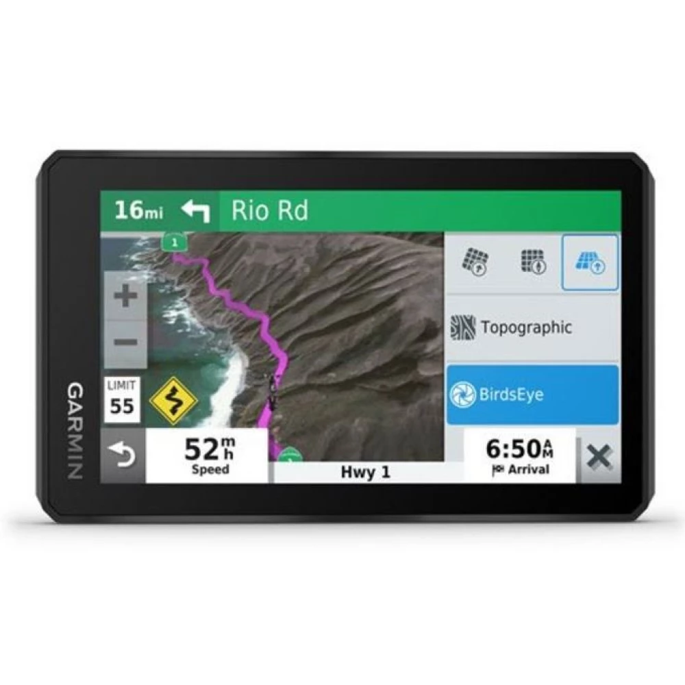
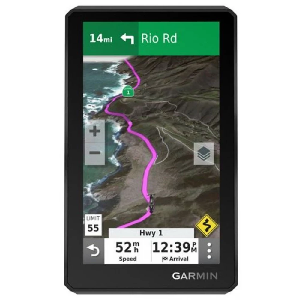
- Simply switch from European street maps to topographic map or Birdseye satellite images with just one touch.
- The trail fixer stores your best trips so you don't have to worry about it.
- Stay on your wake, as you will receive warnings on sharp bends or other dangers.
Adventure
- The 5.5 "display is brighter than any previous zumon, so it can be seen between any light conditions. Glove friendly and can be used in Lying or Standing mode.
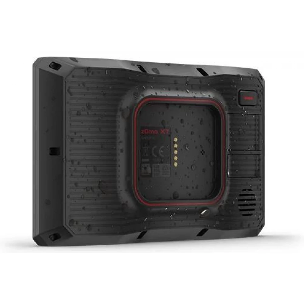
- Whatever the path, this device can withstand all weather conditions (IPX7) and withstand the difficult terrain.
- With 100% brightness, it operates for up to 3.5 hours and for up to 6 hours with general use. To use it further, it can be fixed on the external power.
Discover the terrain
- Birdseye satellite shots can add the displayed map that you can download directly to the device via Wi-Fi® connection.
- You can easily navigate with pre -loaded European maps.
- During your adventurous paths, you can navigate away from public roads, as it also contains a topo database pre -loaded.
- You can quickly switch between road and top maps or satellite shots, so you can always see the right map for that road.
- Garmin Adventure Routes: Instead of straight roads, choose winding, more exciting roads.
- Fix your route with the track recorder so you can review them again later.
- You can easily transfer your GPX files from your phone3 to Zumo XT or share GPXs with your rider via Garmin Drive ™.
Bikers
- You can see travelers' evaluations to hotels, restaurants and attractions in the triplevisor.
- The Zumo XT contains many interesting points (POI) and millions of popular places thanks to the Foursquare® database.
- You can get notifications of dangers such as sharp bends or speed limit. In addition, it warns of helmet controls and speed meters.
- You can easily manage and review your routes, trails or road points on your navigation device, smartphone or computer on Garmin Explore ™.
- You will notify the following rounds through your helmet or headphones.
- mediate t
- Music or mp3 from your phone to your Zumo XT navigator- so you can listen to your helmet in your journey.
Stay calm, motorcycle relationship
- Bluetooth® technology can easily call. If the Garmin Drive app is running on the phone, you can see smart notifications on the Zumo display.
- You can even get real -time traffic and weather information, which you can share with the others through the Garmin Drive ™ application on your phone.
- Associate your Zumo XT with Inreach satellite communicator for two -way messaging, position sharing and emergency help.
- If an accident occurs, the system sends a text message to a predefined connection.
- You can update a map and system software through a built-in Wi-Fi connection without using a computer. Notification will appear on the screen when an update is available.
Technical data
- Size (wind. X core. X deep): 8.8 x 14.8 x 2.4 cm
- Display size: 12.1 x 6.8 cm; 13.9 cm diagonal
- Display Type: Multi-touch glass with high brightness HD color TFT display with white backlight
- Mass: 262 g
- Battery / Operation time: Refill lithium-ion / up to 6 hours (100% brightness 3.5 hours)
- Waterproof: IPX7
- GPS receiver type: GPS / GLONASS / GALILEO
- Built -in memory / memory card: 32 GB / MicroSD can be expanded
- Map Management: Pre -loaded City Navigator Europe NTU with 3D buildings and terrain, Birdseye supported
- Resolution: 1280 x 720 pixels
- Waypoints / Favorites / Locations: Up to Memory Capacity
- Routes / trails: up to memory capacity
- Automatic route planning (round-to-turn)
- Wireless technologies: Wi-Fi / Bluetooth / Ant+
- Foursquare POI Database
- Tripadvisor Poi database
- Sound instructions
- traffic information (Smartphone link)
- Lifetime traffic information
- band information intersection with preview
- Bluetooth handsfree
- Display of speed limit
- smartphone notifications
- Wi-Fi Mapping Software Update
- Live Services via SmartPhone Link
- Notifications to a sharp bend,
PRICE NOTIFICATION
Recommended for you
Similar products
NOTEBOOK SEARCH
OPINIONS
OPINIONS
